Saturday morning we had a leisurely breakfast of biscuits and apples in the room before heading out for the day. Because the morning was overcast, we decided to explore the other side of the island including the German Village before coming back to spend a bit of time on the beach.
Sangju is not well situated for bus travel to the far side of the island. We caught a 10:40 bus from Sangju to Mijo, which is an active port on the south-eastern part of the island. We had a bit of spare time in Mijo before we could catch a bus to the German village so we explored the port.
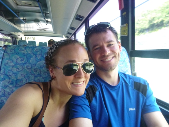
Bus selfie on the way to Mijo.
They were in the process of upgrading the port facilities, so things were pretty loud, but the town itself is actually interesting. There appear to be fewer places to stay than in Sangju, but there seems to be a bit more variety in restaurant selection. We actually like the general feeling of Mijo better than Sangju. It has more character. There is a sense that this is a working town rather than a tourist spot. We saw fewer foreigners and most of the locals seem to be fishermen rather than minbak owners. The town is built into a hill and has a lot of those narrow, windy streets that are so interesting. Unfortunately, there is no beach inside the town; you would have to catch a bus to reach one.
Right on the port side there is a coffee shop called Cafe ét Thé where we stopped to relax near the water while waiting for our bus. Coffees were very good and they also have ice cream and a variety of other snacks. The best part was being able to sit outside above the water. It was a bit loud with the construction going on across the way, but still nicer than being cooped up on a beautiful day.
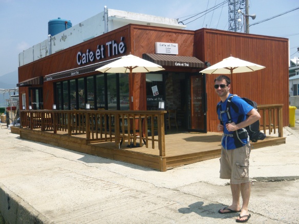
Blake in front of Cafe et The.
We caught the 12:25 bus up the coast road, which is a really pretty drive, to the German Village stop (Mulgeonmaeul). The German Village (독일마을) was established a little over 10 years ago to help Koreans (and their families) who had gone to work in Germany after World War Two feel comfortable settling back into Korea. It was not really designed as a tourist destination. But it has certainly become one.

Tamara at the entrance to the German Village.
We got off the bus to find the main road into the village nose-to-tail traffic with the usual impatient honking. The village is built into a hill with a view of the sea and the parking lot is at the top of the hill. This means all the tourist vehicles must go through the village to park causing quite the traffic snarl. To say side walks were also crowded would be an understatement. One of our friends had recommended a visit to a little shop down a side street that sells home-made bratwurst, but when we eventually located the shop it seemed to be closed for the weekend. We were forced to visit Cafe Liebe for our sausage fix. While it was decent food, it was certainly not home-made and four sausages and some fries cost 20,000₩!

Beer and sausages at Cafe Liebe.

Even in the German Village, the Korean propensity for putting exercise equipment on hills is evident.

A view out over the German Village. There is a smaller Korean village near the sea.

A Cafe right near the village entrance.
We did run into some of Tamara’s students while we were eating. Of course their parents insisted on taking a photo of all their kids with the English teacher on Namhae. They were pretty cute kids, so we got one as well.

Tamara with some of her students.
Overall, the German Village was a bit of a disappointment. If it were not so overrun by tourists, and consequently overpriced, it might be a nice place to wander through. Possibly non-holiday weekends are better. We don’t really know. But, based on our experience, it is not somewhere we would recommend visiting unless you are already in the area.
Once we finished off our sausages and a beer for Blake, we headed back down the hill and caught the 2:40 bus back to Mijo and then another on to Sangju. Our plan was to head out to the beach while it was still relatively warm. The weather had been on and off cloudy all weekend so we were not holding out for a blue-skied afternoon for sunbathing, but we hoped to get a few rays and a swim.
Unfortunately, the wind coming off the ocean had picked up and was strong enough to blow the sand around pretty powerfully. Coupled with the overcast sky it made for a pretty chilly beach experience so we only lasted about an hour. Blake got in a quick swim and then we headed back to the room to get cleaned up and change.
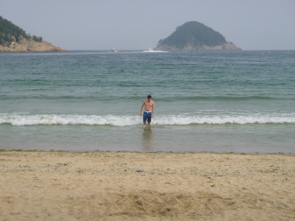
Blake out for a quick dip. The water was quite shallow for a ways out.
The rest of the evening was spent exploring Sangju looking for a good restaurant. Not that there is a major shortage, but we were not really feeling like seafood at that moment. Looking out from the main beach, you can see a couple of restaurants and other buildings on a point to your left. We wandered out to see what was there and discovered two seafood restaurants and a ton of fishermen. Apparently, this is the place to go if you want to do a bit of fishing on your vacation.
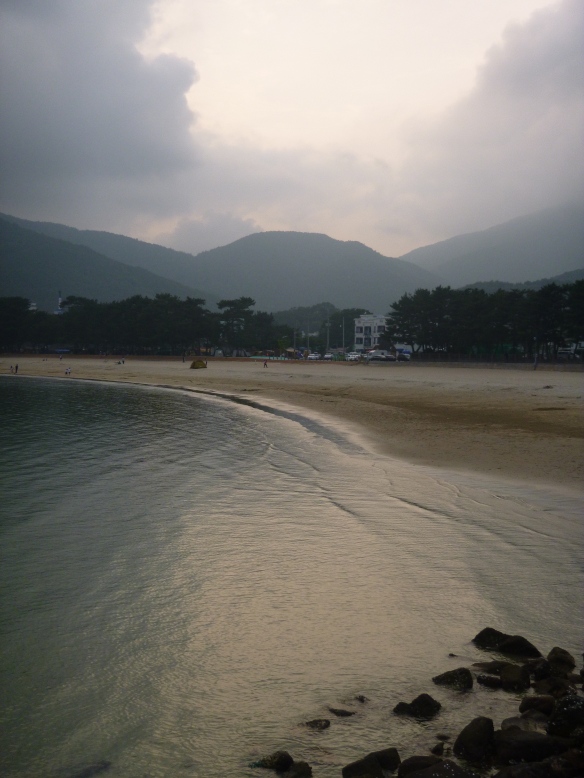
Looking along Sangju Beach during our evening stroll.
Eventually, we found a little restaurant in the middle of town that looked promising and settled in for a meal. Unfortunately, Tamara forgot what 멸치 (myeolchi) means, and so in ordering myeolchi ssambap, we soon received a heavily spiced dish with green onions, garlic, and (is-that-what-I-think-it-is) whole anchovies that you wrap in lettuce with some rice. Of course most people eat these little four inch fish whole, but the bones were a bit much for us. Not quite the dinner we had in mind.

There were several murals involving garlic in Sangju, but this was the best one that we found.
After dinner we went for a short wander along the beach before heading back to our room to read and relax.
Sunday morning came quickly, and after Tamara took a quick dip in the ocean, we packed up and headed home. Long weekends usually mean really crowded buses, and you are not able to reserve a specific bus to or from Namhae. We caught the 9:10 bus north to Namhae Eup (complete with local teens blasting music in the back), then jumped on the next bus to Jinju where we had lunch before getting on the 1:00 bus back to Gwangju.
Namhae Logistics
Getting Around: Buses from Namhae Eup seem to go down either side of the island to Mijo, then turn around and head back. This means that if you want to explore the opposite side, you must catch a bus to either Mijo or Namhae Eup first. Most buses around the island will cost between 1,500₩ and 3,000₩ from place to place and they run roughly every 45 minutes to an hour.

Schedule of buses from Namhae to Sangju/Mijo.
Accommodation: There are accommodations all over the place – mostly minbak and pensions – but apparently options along the beaches are full during July and August. In hindsight, we probably would have been better off staying in Mijo. It is more convenient for buses and we liked the feel of the town more. However, those planing to just lie on the beach will want to stay in Sangju or any one of the other beach towns. In Sangju, you can also camp near the beach.
Getting There: Getting to the southern part of Namhae without a car can be a little bit tricky. Our total travel time on the way home was over 6 hours and our connections lined up really well. From Gwangju there appear to be two main routes. The first is through Suncheon and the second is through Jinju. We chose the Jinju route because there are way more buses between Jinju and Namhae than there are between Suncheon and Namhae.
-

-
Only four buses to Gwangyang/ Suncheon.
-

-
Bus times from Namhae to Jinju.
-

-
Bus times from Jinju to Namhae.
-

-
Bus schedule at the direct bus stop in Jinju.
Food: We have discovered that islands around Korea, for the most part, don’t have a lot of great food options if you are not feeling like Korean-style seafood. Breakfast options are basically nil. We suggest that you bring some good instant coffee, cereal and bowls, biscuits, instant oatmeal, and/or some fruit with you – unless, of course, you like rice, fish soup, and kimchi for breakfast. Those planning to stay in a Pension, these often have cooking areas included, so bringing your own lunch and dinner goods may be a viable option.